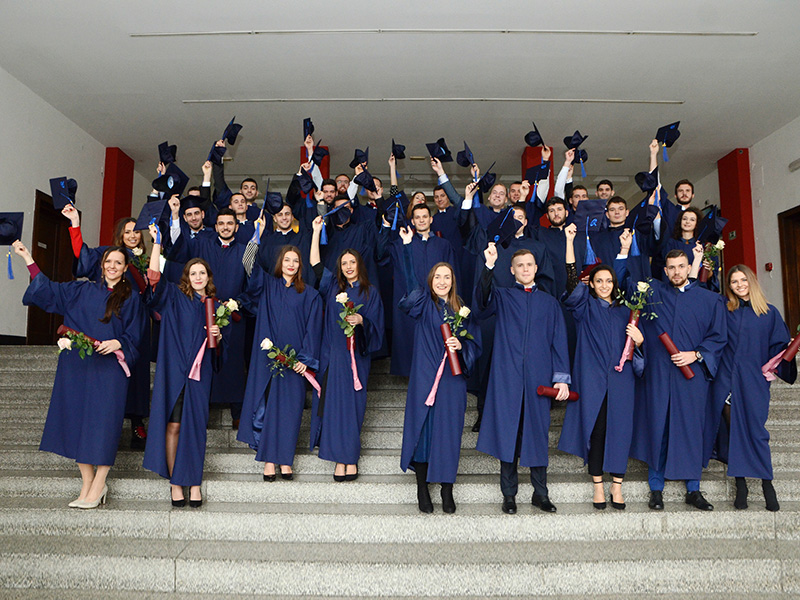
1. OPIS PREDMETA - OPĆE INFORMACIJE |
|||||||||
1.1. Nositelj predmeta |
Siniša Mastelić Ivić |
1.6. Godina studija |
II. |
||||||
1.2. Naziv predmeta |
Uređenje zemljišta |
1.7. Bodovna vrijednost (ECTS) |
5 |
||||||
1.3. Suradnici |
Hrvoje Tomić |
1.8. Način izvođenja nastave (broj sati P+V+S+e-učenje) |
60 (30P-30V) |
||||||
1.4. Studijski program (preddiplomski, diplomski, integrirani) |
Preddiplomski |
1.9. Očekivani broj studenata na predmetu |
90 |
||||||
1.5. Status predmeta |
Obavezni |
1.10. Razina primjene e-učenja (1., 2., 3. razina), postotak izvođenja predmeta on line (maks. 20%) |
e-učenje razine 2 |
||||||
2. OPIS PREDMETA |
|||||||||
2.1. Ciljevi predmeta |
Upoznati studente s:
globalnim okvirom upravljanja zemljištem kao resursom. prostornim gospodarenjem kao procjenom vrijednosti, potražnje i dostupnosti prostora.
Informacijskom prostornom podrškom za upravljanje prirodnim resursima kod planiranja projekta i monitoringa utjecaja.
Mjerama i tehničkim zahvatima koji utječu na promjenu stanja u prostoru, posebno poljoprivrednih i građevinskih.
Podlogom za prostorno planiranje.
Ruralnim i urbanimrazvojemi zakonskom regulativom prostornog planiranja kao utjecajem na mjere i zahvate u prostoru.
Osnovnim principima održivog razvoja kroz oblike korištenja zemljišta.
Različitim postupcima realizacije dokumenata prostornog uređenja. |
||||||||
2.2. Uvjeti za upis predmeta i ulazne kompetencije koje su potrebne za predmet |
Položeni predmeti: Katastar Zemljišno-knjižno pravo |
||||||||
2.3. Ishodi učenja na razini programa kojima predmet pridonosi |
Određivati i interpretirati veličine, svojstva i odnose objekata u prostoru na temelju mjerenih podataka, baza prostornih podataka, planova i karata.
Poznavati propise i upravni okvir važan za geodeziju i geoinformatiku, propise o autorskim pravima, objavljivanju i razmjeni prostornih podataka.
Poznavati upisnike nekretnina i interesa na njima, razumjeti mjere uređenja zemljišta i metode vrednovanja zemljišta.
Pratiti i usvajati nova tehnološka dostignuća u području geodetske izmjere, geoinformacijskih sustava i usluga temeljenih na položaju te promjene propisa, normi i standarada.
Izrađivati geodetske elaborate za potrebe izrade, održavanja i upisa u katastar i zemljišnu knjigu te elaborate za inženjerske radove.
Održavati topografske, kartografske, pomorsko navigacijske i zemljišne informacijske sustave, integrirati i vizualizirati prostorne informacije. |
||||||||
2.4. Očekivani ishodi učenja na razini predmeta (4-10 ishoda učenja) |
Studentice i studenti će: - Pripremiti geoprostorne podatke geomarketinške podloge za mjere gospodarenja prostorom, kao podrške izradi strategije razvoja - Procijeniti vrijednosti poljoprivrednog zemljišta, razvrstavanjem zemljišta pojedinih kultura u razrede plodnosti na osnovu razvojnog stupnja, teksture, geološkog porijekla i stupnja vlažnosti - Procijeniti vrijednosti urbanog prostora s različitim tipovima vrijednosti prostora, glavnim društvenim, gospodarskim, okolišnim i političkim utjecajima na vrijednost prostora - Implementirati procijenjene vrijednosti u informacijski sustav za prostornu prezentaciju vrijednosti prostora - Razlikovati načela zemljišne politike i implementacije (realizacije) prostornih planova, ulogu te praćenje i kontrolu - Provesti geodetsko tehničke mjere uređenja zemljišta: komasacije, arondacije, urbane komasacije, izvlaštenja i parcelacije, kao metode konsolidiranja terena kod suprotstavljenih koncepata (statički i dinamički) brige o prostoru - Analizirati osobine slivnog područja za provedbu geodetsko tehničkih mjera uređenja zemljišta - Razlikovati hijerarhiju planiranja prostornog uređenja, svrhu javnog planiranja, metode planiranja i pravni status |
||||||||
2.5. Sadržaj predmeta detaljno razrađen prema satnici nastave |
Koncept zemljišta i važnosti njegove uloge u društvu te dinamika odnosa civilizacije i zemljišta. Različite perspektive i percepcije zemlje, prava, odgovornosti i obaveze na zemljištu.Razvoj odnosa civilizacije i zemljišta. P6
Prostorni podaci u geomarketinškoj podlozi kao podršci formiranju strategije razvoja. Hhijerarhijski pristup planiranja prostornog uređenja, svrha javnog planiranja, metode planiranja, razine planiranja i pravni status planiranja. Kreiranje vektorskih prostornih podataka upotrebom web servisa. P2, V6
Procjena vrijednosti poljoprivrednog zemljišta, razvrstavanjem zemljišta pojedinih kultura u razrede plodnosti na osnovu razvojnog stupnja, teksture, geološkog porijekla i stupnja vlažnosti. Implementacija u informacijski sustav za prostornu prezentaciju razreda plodnosti. P4
Procjena vrijednosti urbanog prostora s različitim tipovima vrijednosti prostora,glavnim društvenim, gospodarskim, okolišnim i političkim utjecajima na vrijednost prostora. Implementacija u informacijski sustav za prostornu prezentaciju vrijednosti urbanog prostora. P4
Modeliranje vektorskih prostornih podataka teuspostava GIS-a za prostorne analize korištenjem GIS desktop aplikacije. V14
Realizacija prostornih planova s praćenjem i kontrolom. Službena provedba stimulansa za efikasnost implementacije. Ciljevi i namjene javnog utjecaja pri razvoju prostora. Neovisne i proceduralne planske kontrole. Informacijski sustav prostorne prezentacije procjene utjecaja razvoja na prirodnu okolinu. P4
Geodetsko tehničke mjere uređenja zemljišta: komasacije, arondacije, urbane komasacije, izvlaštenja i parcelacije, kao metode konsolidiranja terena kod suprotstavljenih koncepata (statički i dinamički) brige o prostoru.Izrađivanje tehničkog izvješća o projektu intervencije u prostoru. P6, V10
Informacijski sustav za podršku upravljanja slivnim područjem s fizičkim karakteristikama slivnog područja, modeliranjem reljefa slivnog područja s identifikacijom osobina razvođa, mreže kanala i kaskada površinskog toka. P4 |
||||||||
2.6. Vrste izvođenja nastave: |
predavanja seminari i radionice vježbe on line u cijelosti mješovito e-učenje terenska nastava |
samostalni zadaci multimedija i mreža laboratorij mentorski rad (ostalo upisati) |
2.7. Komentari: |
||||||
|
|||||||||
2.8. Obveze studenata |
Aktivnosti:
Zadaća: Javni uvid
Projekt: Kreiranje vektorskih prostornih podataka upotrebom web servisa
Provjera samostalne izrade:Kreiranje vektorskih prostornih podataka upotrebom web servisa
Projekt: Uspostava GIS-a za prostorne analize Provjera samostalne izrade: Uspostava GIS-a za prostorne analize
2 međuispita
Nazočnost na nastavi (vježbe i predavanja) |
||||||||
2.9. Praćenje rada studenata (upisati udio u ECTS bodovima za svaku aktivnost tako da ukupni broj ECTS bodova odgovara bodovnoj vrijednosti predmeta): |
Pohađanje nastave |
0.25 |
Pismeni ispit |
2 |
Projekt |
1 |
|||
Eksperimentalni rad |
|
Istraživanje |
|
Praktični rad |
0.75 |
||||
Esej |
|
Referat |
|
(ostalo upisati) |
|
||||
Kolokviji |
|
Seminarski rad |
|
(ostalo upisati) |
|
||||
|
|
Usmeni ispit |
1 |
(ostalo upisati) |
|
||||
2.10. Ocjenjivanje i vrjednovanje rada studenata tijekom nastave i na završnom ispitu |
Kontinuirano praćenje i mogućnost oslobađanja od pismenog dijela ispita. Vrednuje se pohađanje nastave, projekti, zadaća, međuispiti. Konačna ocjena je na usmenom ispitu. |
||||||||
2.11. Obvezna literatura (dostupna u knjižnici i putem ostalih medija) |
Naslov |
Broj primjeraka u knjižnici |
Dostupnost putem ostalih medija |
||||||
Vjenceslav Medić (1978): AGRARNE OPERACIJE, Geodetski fakultet, Zagreb |
|
Elektronički dokument na intranetu predmeta |
|||||||
Gerhard Larsson (1997): Land Management, Stockholm. |
|
|
|||||||
Robert Laurini (2001): Information Systems for Urban Planning, Taylor and Francis. |
|
|
|||||||
Mastelić, I. S.: Uređenje zemljišta - folije s predavanja, Geodetski fakultet, Zagreb 2013. |
|
Elektronički dokument na intranetu predmeta |
|||||||
|
|
|
|||||||
2.12.Dopunska literatura (u trenutku prijave prijedloga studijskoga programa) |
|
||||||||
2.13.Načini praćenja kvalitete koji osiguravaju stjecanje izlaznih kompetencija |
Sukladno Politici kvalitete i Priručniku za kvalitetu Sveučilišta u Zagrebu te Sustavu osiguranja kvalitete Geodetskog fakulteta. Anketno vrednovanje predmeta i nastavnika. Samovrednovanje nastavnika. |
1. GENERAL INFORMATION |
|||||||||
1.1. Course teacher |
Siniša Mastelić Ivić |
1.6. Year of the study programme |
II. |
||||||
1.2. Name of the course |
Land Management |
1.7. Credits (ECTS) |
5 |
||||||
1.3. Associate teachers |
Hrvoje Tomić |
1.8. Type of instruction (number of hours L + S + E + e-learning) |
60 (30L + 30E) |
||||||
1.4. Study programme (undergraduate, graduate, integrated) |
undergraduate |
1.9. Expected enrolment in the course |
90 |
||||||
1.5. Status of the course |
mandatory |
1.10. Level of application of e-learning (level 1, 2, 3), percentage of online instruction (max. 20%) |
e-learning, level 2 |
||||||
2. COUSE DESCRIPTION |
|||||||||
2.1. Course objectives |
To introduce students to: The global framework of land management as a resource. Spatial management as combination of valuation, market demand and availability of space. Spatial support Information system for management of natural resources in project planning and monitoring the impact. Technical procedures that affect the change of the situation in space, especially agricultural and construction. The geospatial data as the basis of physical planning. Rural and urban development and physical planning legislation as the influence on the projects in the area. The basic principles of sustainable development through forms of land use. Various methods of physical planning documents implementation. |
||||||||
2.2. Course enrolment requirements and entry competences required for the course |
Passed course exams: Cadastre Land Book / Real estate law |
||||||||
2.3. Learning outcomes at the level of the programme to which the course contributes |
Determine and interpret the size, properties and relations of objects in space on the basis of measured data, spatial databases, plans and maps.
Demonstrate competences in regulations and administrative framework important for geodesy and geoinformatics, the regulations related to copy right, publishing and exchange of spatial data.
Demonstrate competences in real estate registers and interests in real estates, understand land development measures and methods of land evaluation.
Solve practical tasks in surveying, spatial data collection, real estate evaluation and management.
Prepare geodetic documents needed to establish and maintain cadastral records and land registry, as well as the documents for engineering works.
Maintain topographic, cartographic, maritime and navigation, and land information systems, integrate and visualise spatial information. |
||||||||
2.4. Learning outcomes expected at the level of the course (4 to 10 learning outcomes) |
The students will be able to: Prepare geospatial data as the basis of geomarketing for land management, to support the preparation of development strategy. Assess the values of agricultural land, classify land in the individual cultures on the basis of fertility, developmental stage, texture, geological origin and degree of humidity. Assess the values of urban space with different types of values of the space, assess the main social, economic, environmental, and political influences on the value. Implement the estimated value in the information system for the spatial presentation of the space values – value maps. Distinguish the principles of Land Policy and realization of physical planning, and the role of monitoring and control. Conduct geodetic technical measures land regulation: land consolidation, readjustment, urban land consolidation, expropriation and allotment, as consolidation method in the two opposed concepts (static and dynamic) care of space. To analyse the characteristics of the water catchment area for the implementation of geodetic and technical measures land development. Distinguish the hierarchy of organizing spatial planning, the purpose of public planning, planning methods and legal status. |
||||||||
2.5. Course content broken down in detail by weekly class schedule (syllabus) |
The concept the land and the importance of its role in society and the dynamics of civilization and the land. Different perspectives and perceptions of land, rights, responsibilities and obligations on the land. Relationship development of civilization and the land. L6
Spatial data as the basis of geomarketing analysis as support the creation of strategic development plan. Hierarchical approach to organizing spatial planning, the purpose of public planning, planning methods, levels of planning and legal status of planning. Creating vector spatial data using web services. L2, E6
Estimating the value of agricultural land by land classification of individual cultures in fertility classes based on developmental stage, texture, geological origin and degree of humidity. The implementation of the information system for spatial presentation of fertility classes. L4
Assess the values of urban space with different types of values of the space, assess the main social, economic, environmental, and political influences on the value. Implement the estimated value in the information system for the spatial presentation of the space values – value maps. L4
Modelling of vector spatial data and the establishment of GIS for spatial analysis using GIS desktop applications. E14
The implementation of spatial plans with monitoring and control. The official implementation of incentives for efficiency of implementation. The objectives and purposes of public influence in the development of the area. Independent and procedural planning control. The Spatial Presentation Information System of the impact assessment of development on the natural environment. L4
Distinguish the principles of Land Policy and realization of physical planning, and the role of monitoring and control. Conduct geodetic technical measures land regulation: land consolidation, readjustment, urban land consolidation, expropriation and allotment, as consolidation method in the two opposed concepts (static and dynamic) care of space. L6, E10
The river information system to support river basin management with the physical characteristics of the water catchment area, modelling the relief the water catchment area with the identification of watershed area, network of canals and cascades of surface flow. L4 |
||||||||
2.6. Format of instruction: |
lectures seminars and workshops exercises on line in entirety partial e-learning field work |
independent assignments multimedia and the internet laboratory work with mentor (other) |
2.7. Comments: |
||||||
|
|||||||||
2.8. Student responsibilities |
Activities:
Project: Creating of a vector spatial data using web services. Project: Establishment of GIS for spatial analysis
2 mid-term exams
The presence in classes (lectures and exercises). |
||||||||
2.9. Screening student work (name the proportion of ECTS credits for each activity so that the total number of ECTS credits is equal to the ECTS value of the course ) |
Class attendance |
0.25 |
Research |
|
Practical training |
0.75 |
|||
Experimental work |
|
Report |
|
(other) |
|
||||
Essay |
|
Seminar essay |
|
(other) |
|
||||
Tests |
|
Oral exam |
1.0 |
(other) |
|
||||
Written exam |
2.0 |
Project |
1.0 |
(other) |
|
||||
2.10. Grading and evaluating student work in class and at the final exam |
Valuated are: attendance and project. The final exam consists from two parts: written and the oral exam. |
||||||||
2.11. Required literature (available in the library and via other media) |
Title |
Number of copies in the library |
Availability via other media |
||||||
Vjenceslav Medić (1978): AGRARNE OPERACIJE, Geodetski fakultet, Zagreb |
|
Electronic document via e-learning |
|||||||
Gerhard Larsson (1997): Land Management, Stockholm. |
|
|
|||||||
Robert Laurini (2001): Information Systems for Urban Planning, Taylor and Francis. |
|
|
|||||||
Mastelić, I. S.: Uređenje zemljišta - folije s predavanja, Geodetski fakultet, Zagreb 2013. |
|
Electronic document via e-learning |
|||||||
|
|
|
|||||||
|
|
|
|||||||
2.12.Optional literature (at the time of submission of study programme proposal) |
|
||||||||
2.13.Quality assurance methods that ensure the acquisition of exit competences |
In accordance with the University of Zagreb Quality Policy and Quality Manual and the Faculty of Geodesy quality assurance system. Student evaluation of subject and teachers. Self-evaluation of teachers. |
||||||||
2.14.Other (as the proposer wishes to add) |
|
- Nositelj(ica) predmeta: Siniša Mastelić-Ivić
- Suradnik(ica): Hrvoje Tomić